
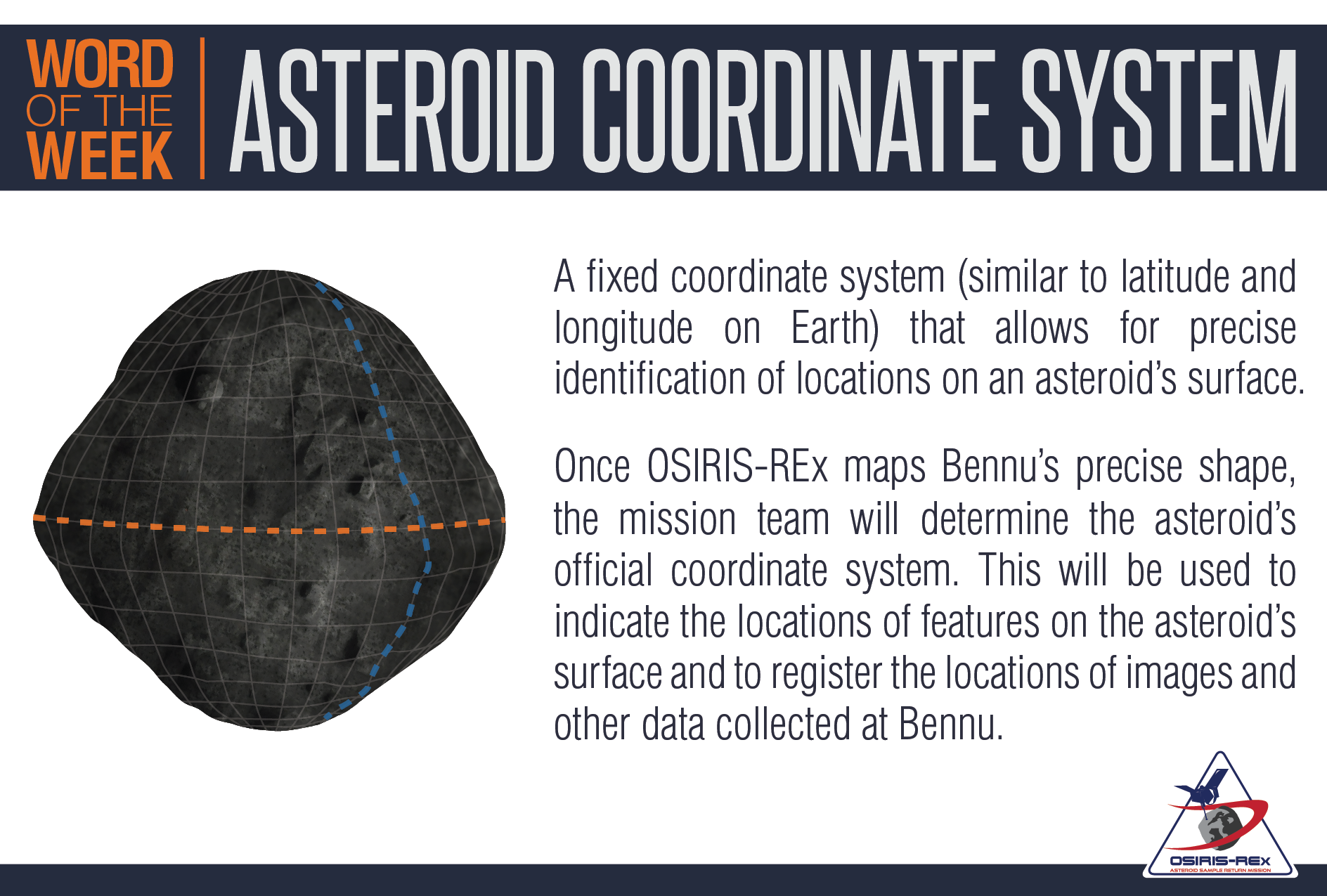
Word of the Week: Asteroid Coordinate System
A fixed coordinate system (similar to latitude and longitude on Earth) that allows for precise identification of locations on an asteroid’s surface.
Once OSIRIS-REx maps Bennu’s precise shape, the mission team will determine the asteroid’s official coordinate system. This will be used to indicate the locations of features on the asteroid’s surface and to register the locations of images and other data collected at Bennu.
Credit: University of Arizona
Downloads:
full (1888x1275) | thumbnail (150x150) | medium (300x203) | medium_large (640x433) | large (640x433) | 1536x1536 (1536x1037) | 2048x2048 (1888x1275) | banner-xm (427x240) | banner-sm (640x360) | banner-med (854x480) | banner-large (1024x576) | banner-full (1280x720)